Member utilities can provide Web Map Services (WMS) or Web Feature Services (WFS) links to Missouri 811 to display their facilities within OCC's Locator Ticket Management (LTM) and/or IMAP, making it a convenient way to compare the MO811 ticket information with the facility locations all in one application.
The WMS/WFS links are generated/hosted by the member utility's GIS mapping software and provide instantly synchronized data to Missouri 811/OCC's applications and the utility's locators. The data is kept secure behind login access and displayed only to the users who manage the locate tickets or utility notification areas. WMS/WFS displays are not available to excavators.
Displaying the utility facility locations within LTM assists the locators both in accurately comparing the dig site with the underground facilities to more easily clear a locate ticket and/or be able to confirm locates when marking on site. The facilities are displayed (color, size, symbology) the same as on the utility's end, making it familiar and easily understood with the ticket information. If multiple facility layers are provided, the different layers can be toggled on and off.
Displaying the utility facility locations within IMAP allows GIS users to manually compare and ensure the Missouri 811 notification area fully encompasses where underground facilities are located and where the utility needs to be notified for digging.
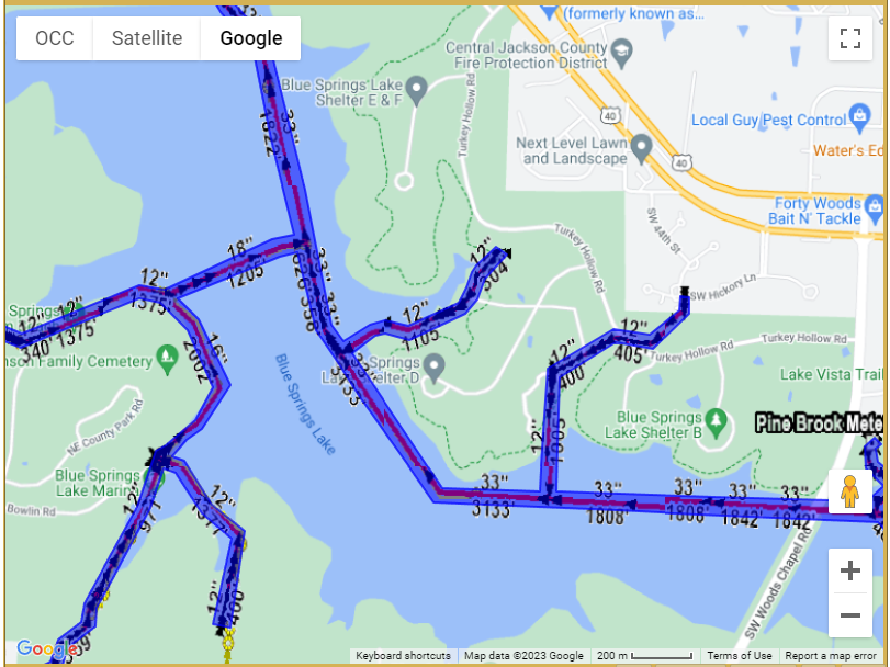
This shows the utility's notification area (blue polygon) and the facility centerline with measurement details (red line, black numeric measurements and arrows, yellow circles - provided via WMS links for display)
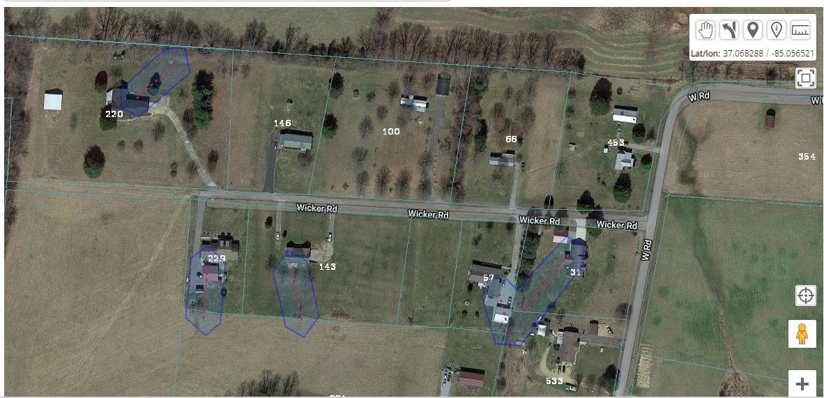
This shows the utility's notification area (blue polygon) and the facility centerline (red dashed line - provided via WMS links for display)
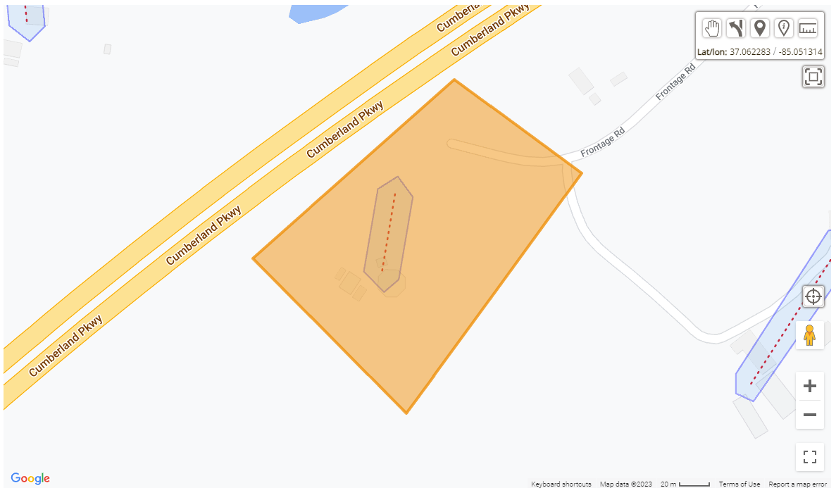
This shows the dig site location (orange polygon), the utility's notification area (blue polygon) and the facility centerline (red dash line - provided via WMS links for display)
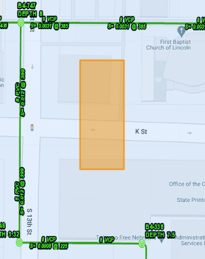
This shows the dig site location (orange polygon) and the facility centerline (green line with labels - provided via WMS links for display)
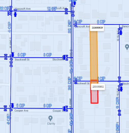
This shows the dig site location (orange polygon), corresponding locate (red polygon) and the facility centerline (blue line and symbols with labels - provided via WMS links for display)