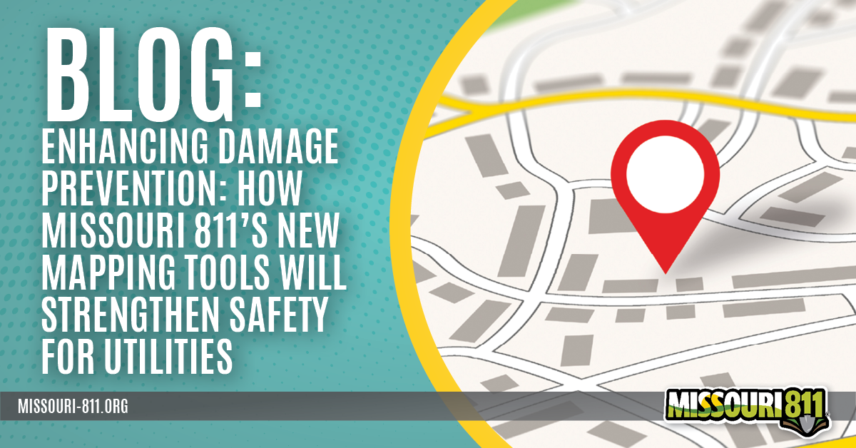
Accurate mapping and clear communication between utilities and excavators remain two of the most critical components of underground damage prevention. As rural communities grow, utility systems expand, and infrastructure becomes more complex, the demand for clear, reliable information continues to increase. To support utilities in meeting these challenges, Missouri 811 is rolling out two major advancements: Enhanced Locator Mapping, which is already available for use, and Enhanced Positive Response, scheduled for release in 2026.
These tools are designed to streamline the locating process, reduce the chance of mistakes in the field, and equip both utilities and excavators with better, clearer information. Together, they represent an important step forward in making Missouri’s underground infrastructure safer and easier to protect.
Enhanced Locator Mapping: A Smarter Way to Locate
Enhanced Locator Mapping (formerly known as Web Mapping Service or Web Feature Service integration) is designed to solve one of the most common challenges locators face today: the need to compare two separate maps while reviewing a ticket.
Traditionally, when a locator receives a Missouri 811 ticket, it includes a map showing the excavator’s stated scope of work. The locator must then pull up a separate internal utility map, often from a GIS department, and mentally determine how the two relate. If the locator misreads either map, or if the maps do not align visually, the risk of unnecessary marks, missed lines, or incorrect locations increases.
Enhanced Locator Mapping eliminates that risk.

How It Works
Missouri 811 collaborates with the utility’s GIS department to securely access a live, continuously updated web mapping service. Utilities may provide this through:
- An unencrypted web link
- A secure username and password protected link
Once connected, Missouri 811 overlays the utility’s live GIS data directly onto the excavator’s scope-of-work map within the locator’s ticket view. Instead of toggling between two documents, the locator sees a unified, precise map showing:
- The exact dig area
- The utility’s own infrastructure layers
- How each line relates to the excavation site
As Nick Rasa, Chief Operating Officer at Missouri 811, explains, “Utilities are always updating and improving their system. Using a live web service ensures that the locator is always seeing the most current map possible. Static map files go out of date almost immediately.”
Why It Matters
Accurate, real-time GIS data helps utilities:
- Reduce misreads and mistakes when reviewing scope boundaries
- Prevent unnecessary locates
- Speed up field decisions
- Improve locating consistency across all stakeholders
The system is designed to work especially well for in-house locators but may also be used with contracted locators.
Only the Utility Sees Its Own Data
Utilities can rest assured that their information remains private. Enhanced Locator Mapping is not visible to excavators or other utilities on the ticket.
Each utility sees only its own map, and only within its internal locating workflow. The goal is to help the locator make better, faster decisions without exposing system maps to outside parties.
Low Barrier to Adoption
Many utilities, large and small, have already made the switch. Most modern GIS systems can generate web mapping services at little or no additional cost, making this an accessible enhancement for utility systems of all sizes. Several small utilities are already using the service successfully.
Enhanced Positive Response: Coming in 2026
Building on the foundation created by Enhanced Locator Mapping, Missouri 811 will introduce Enhanced Positive Response in 2026. This optional service gives excavators a limited, highly controlled look at utility maps, but in a way that prioritizes safety, privacy, and strict guardrails.
What Enhanced Positive Response Provides
After a utility has submitted its status on a ticket, the excavator will see a new link next to each status labeled “View Map.” When selected, this displays a map with the utility lines within the excavation area.
Utilities can share as little or as much detail as they feel comfortable with. Some may only show the presence of a line, while others may choose to include attributes such as size or material. Utilities will have the ability to customize as they see fit.

Guardrails That Protect Utilities
Missouri 811 understands that utilities may be cautious about allowing excavators to see even a small portion of their GIS data. Enhanced Positive Response is designed with restrictions to address these concerns:
- Excavators cannot scroll outside the dig area
- Maps are visible during the lifespan of a ticket (aka: Ticket Life)
- Maps are clearly labeled “for reference only” and are not intended for excavation
- Utilities choose exactly which layers appear
- Excavators cannot view any information outside their specific job site
These protections ensure that sensitive utility data remains secure while still improving communication in the field.
Proven Results from Washington D.C.
A pilot program in Washington, D.C. demonstrated the effectiveness of this approach. Preliminary data showed that when excavators received limited, safeguarded visibility into utility lines, damages were reduced by 70 percent.
This improvement occurs because excavators can confirm that the lines located in the field match what the map indicates should be present. If something appears missing, such as a service line, they can immediately request an Incorrect Locate before beginning work.
As Nick Rasa notes, “Anything we can do to decrease damages is a positive. The results from Washington D.C. show clear benefits with no increase in risk.”
Universal Availability Across Ticket Types
Enhanced Positive Response will be optional for each utility. Once enabled, it can appear on any Missouri 811 ticket type.
Only utilities that opt into the program will have their maps displayed.
Getting Started.
Both Enhanced Locator Mapping and Enhanced Positive Response represent a significant step forward in how Missouri utilities can manage their locating operations. By improving accuracy, strengthening communication, and reducing uncertainty in the field, these tools help create a safer and more predictable environment for everyone involved in excavation work.
For utilities ready to modernize their locating process and reduce preventable damages, Missouri 811 is here to help. To learn more or get started with either service, contact:
Nick Rasa, Chief Operating Officer, Missouri 811
📧 nrasa@missouri-811.org
Missouri 811 looks forward to partnering with utilities across the state to build a safer underground infrastructure for the future.